Please use BACK BUTTON ON BROWSER to return to main list
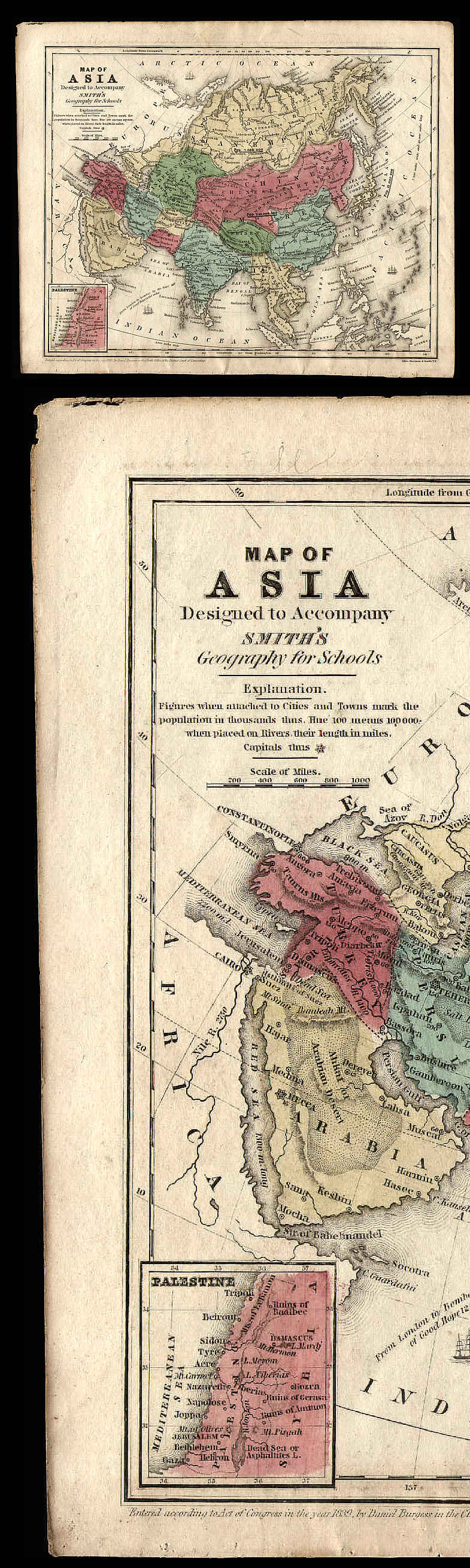
OLD 1839 HAND COLORED MAP OF ASIA
This nice map is removed from the 1844 edition of “Smith’s Atlas Designed to Accompany the Geography by R. C. Smith” or more simply stated: “Smith’s Geography for Schools,” published by John Paine of Hartford, Connecticut (this atlas was apparently first printed in 1839). The map is on a single page, which measures about 9.25 x 11.5” and is titled “MAP OF ASIA Designed to Accompany SMITH’S Geography for Schools”.
The countries of Asia are attractively colored in green, blue, yellow, and pink. There is an inset map of PALESTINE.
At bottom is printed “Entered according to Act of Congress in the year 1839 by Daniel Burgess in the Clerk’s office of the District Court of Connecticut.” Also, “Engraved by Stiles, Sherman, & Smith, NY.” Map has a blank back.
Some age staining (see scan), otherwise good condition. Scan shows map & enlarged detail. Map would look wonderful if framed.
Price= $35.00
Please use BACK BUTTON ON BROWSER to return to main list
ORDERING
INFORMATION
BACK TO HISTORY BROKER HOMEPAGE