BACK TO LIST OF MAPS
BACK TO HISTORY BROKER HOMEPAGE
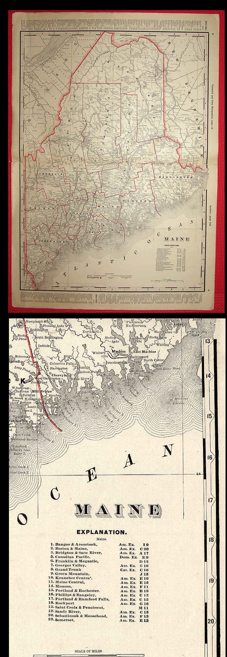
OLD 1895 CRAM’S STATE RAILROAD MAP OF MAINE
BEAUTIFUL original turn of the century RAILROAD map for the state of MAINE as neatly disbound from “Cram’s Standard American Railway System Atlas of the World”, published by George F. Cram, Chicago & New York, 1895. This map is a LARGE double-page map which measures 17 ˝ x 25" (including margins).
This map shows the routes of over 20 railroads operating in the state of ME in this era.
Few minor edge tears, but map is in quite good condition on paper of fine old rag content and would look great if matted / framed. The State and each County is outlined beautifully in red. Some printing on edges & reverse.
“George Cram was born in 1841 and served with the Union forces in the Civil War before going into the map publishing business with his uncle in 1867. Two years later, he founded his own company, publishing maps and atlases. He was one of the first American map makers to start using Lithographic Coloring techniques. His state maps name & number every railroad line by a legend on the map, which gives a detailed glimpse into the prolific rail-system of turn-of-the-century America. Cram’s maps contain great detail including counties, cities and towns, lakes and rivers, mountains, and some other topographical marks. His maps include decorative borders.”
Buyer pays $5.00 postage & handling in US, plus USPS insurance.
VA residents add 5% sales tax to selling price.
Price= $65.00
ORDERING
INFORMATION
BACK TO LIST OF MAPS
BACK TO HISTORY BROKER HOMEPAGE